The journey to the west: only 750 kilometers to go! - Horydoly.cz - Outdoor Generation
HORYDOLY An extraordinary clubhouse
A series of lectures on outdoor topics is held in Vršovice, Prague. Also watch the recording of the lectures by Tomáš Poláček and Kuba Turk's Alpine Troika.
During my cycling tour, I often stopped at caches. Geocaching is my passion. Still, I won't tell you much about the stashes so you can find them yourself. I won't spoil your joy of discovery.
BY BIKE: The journey from north to south or Czech records
VIDEO Kříž nad Českém: from north to south and from east to west
I am taking the Saturday afternoon train to Jablunkov. I get off at eight in the evening and the journey can begin. Today it's supposed to be just a comfortable trip to the easternmost point and an overnight stay at the Czech-Slovak-Poland tri-border. Less than fifteen kilometers.
When I carry a bicycle up the stairs from the platform, it seems to me to be 100 kilos. I took on too much. Four liters of water, sweets, side dishes for cooking on fire, ash, clothes and a lot of other useless things. I end up using them all during the trip. Except for one thing - I never took the knife out of my bag.
Both nationalities mix in the Czech-Polish border area. The names of the villages are written bilingually, only the Polish name hangs above the shops, and when you pass by, you hear more of the noise of a wheel than a bicycle. A large amount of money has been invested in local infrastructure in recent years. It can be seen in the bus stops, which are countless here, and the roads, on which the beautiful new asphalt is laid.
I am going up to the Bukovec border crossing. The old glory of dwarf shops is long gone. All the buildings are in a dilapidated state. It reminds me of American ghost towns.
A path across a meadow leads to the easternmost point of the Czech Republic. This is the Bukovec nature reserve, which is due to the waterlogged environment where rare plant species thrive. I push the bike for the last few meters, because the wet roots would cause me to fall right after a few hours of riding.
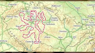
I'm here. It's starting to snow, so the photos won't be very good. There are shelters, the Oleška river and a stone with a metal sign. "Now it all starts," I mutter under my breath: "Just 750 kilometers to go and I'm at the finish line."
I am full of energy, so I decide to continue as planned. It is quite a hill to the Hrčava border crossing, but you can climb it. Halfway up the hill I'm thinking about turning on the flashlight, but I'm not going to stop. In the end, there is no need, because already two kilometers before the village of Hrčava (often wrongly referred to as the easternmost village of the Czech Republic), there are street lamps in the middle of the meadows. What the hell? What's the use of electricity here? I guess we're shining light into the windows for God's sake.
From the village of Hrčava, it is a nice climb down and then up again at the border crossing. I'm looking forward to driving it in the opposite direction tomorrow morning. It didn't happen because I drove it today. Czechs and Poles were socializing together with alcohol in the shelter on the triple border. So I just looked at the place and drove on. It's damp everywhere, so I'll have to find another shelter. In the end, I choose the Markov bus stop at the descent to the Jablunkovské pass. The first bus leaves at 5:15. Hopefully he won't wake me up.
CYCLING TOURISM IN THE EAST: Havel at the end of the world in Hrčava
Only to Štramberk for Štramberské Uši
It is very cold in the Beskydy region in the morning. The fog rolls over the hills and valleys. I really don't want to get up, but I'm glad to start the descent. I put on all the layers of clothing I have and still feel a gust of cold wind every now and then.
The well-known pass, where the village of Mosty u Jablunkova is located, is not visible at all. It only gets brighter in the village of Bocanovice. The morning sun is starting to burn. "I won't be taking out the sunscreen so soon," I think to myself and make a fatal mistake. Then I won't remember him for the whole day and I'll burn my legs and arms red.
I go around the Moravian-Silesian Beskydy along their foothills. It's a constant seesaw. From the village by the stream up the hill to the cross or other sacred monument and down again to the valley of the water course. Going a little further from the mountains, it's completely flat. On the other hand, I can see the Třinec steel mills or Český Těšín, which I first consider to be Ostrava, from a height like this.
Polish names are slowly disappearing and the mountains with them. For the last time, I catch a glimpse of the transmitter on Lysá hora and head for Frýdek-Místek. Along the way, I stop by the Morávka River, which has one of the last natural riverbeds in our territory. The stream runs wild here, which means that it branches off into several arms, moving gravel deposits and thus constantly changing its character.
I will go around Frýdek from the south side and reach the birthplace of music composer Leoš Janáček. I pass his house in a terrible limp. If he rode a bike, I don't envy him the walk home. There are a lot of people on the square in Hukvaldy. It is not surprising, because it is Sunday and one of the largest Moravian ruins is located above the village.
I have lunch in a restaurant in Kopřivnica. Pizza with cold lemonade is more than enough. I've already drunk over three liters today and still can't get enough. I take stamps and leaflets at the information center in the square. A local boy asks me what I need it for. To the answer that it is a souvenir, he replies: "Aha!" Looks like he never took his heels out of his hometown. He doesn't understand that I enjoy traveling.
And why am I actually in Kopřivnice? Because I want to go to Štramberk. The famous Štramberk ears are made here. It is a local delicacy with a legend. The city was besieged by Tatars. The inhabitants hid on Mount Kotouč, where they bravely defended themselves. After a great storm, they dug a pond above the Tartar encampment and washed the besiegers out. Only a few bags with ears were found on the spot. In honor of this famous victory, the so-called Štramberk ears have been baked in Štramberk ever since.
LOCAL DELICIOUSNESS: Štramberské úši
St. Catherine's church from the 14th century stands a little outside the village. It stands next to a cabin camp on a busy road. Nothing in the vicinity. Previously, there was the village of Tamovice, but it only had a few buildings. It looks fixed, so I take a peek inside. A barely grown boy greets me and offers a tour. I don't refuse, so he tells me about archaeological finds under the floor or subsidies from the European Union, thanks to which things are being reconstructed here. He even lets me ring the bell and climb into the attic.
The ruins of Starý Jičín Castle are located on a steep hill, so there is a beautiful view of the surrounding area from it. The ascent, although challenging on a bike, is worth it. It's already early evening, so I'm deciding where I'm going to sleep. In the end, I choose the option of driving to Hranická Propasta and continuing to look for a place to sleep.
Kilometer before the chasm I will pierce. I didn't have time to inflate the tire at the gas station at home, and I thought I'd be able to do it somewhere along the way. This morning I was looking for a gas station in the air, but I couldn't find it. I was doing well, so I forgot about this problem and didn't deal with it again in the afternoon. It took its toll on me off-road, where I punctured the inner tube with the rear rim. Fortunately, I have a spare, so I quickly change. Flies are starting to cluster around. I inflate the bike, but it doesn't work very well with the hand pump. So I'm afraid to ride my bike in the off-road, but I'm already on the road.
I don't really enjoy the border gap because I'm solving a problem with my bike. Fortunately, there is a gas station nearby and they will lend me air as well. On the beautiful cycle path along the Bečva I find a well, where I cook on the fire and lie down in my sleeping bag. It starts to drizzle, so I move under a nearby shelter right on the bike path and fall asleep on the table.
NATURE RECORD: The border chasm is the deepest hole
The non-existent Pluml Hills
I am woken up by the first passing cyclists around five in the morning. They are probably going to Hranice for the morning shift. It keeps me calm and I get out of my sleeping bag after about an hour. It should be mostly flat today, I'm looking forward to it. Along Bečva, the kilometers add up very quickly. I'll be in Přerov in a moment. There I separate from the river and continue to Prostějov.
I drive through endless fields, between which there are dirt roads or asphalt roads connecting villages. The sky is overcast, so it's a pleasant ride. I will make a mistake again and not lubricate myself. After all, it's under a cloud, nothing can burn me. Prostějov is the first larger city I meet. I'm driving on a slip road and I have to weave between cars. I remember spending a whole day here with my friends a few years ago. I'm headed for Plumlov.
I have to take a picture at the sign announcing the beginning of the town. A few years ago, we had a girl at camp who could only talk about this city for the entire two-day camp. After that, we had an inscription on the commemorative card beginning: "Wandering Pilgrim Explores Plumlow Hills." There is no Plumlov Hill, there is only Plumlov Depression, but that doesn't change the smile that the sign put on our lips at the time.
There is a beautiful large castle in Plumlov. Originally, it was supposed to have three more wings, but the plan was never realized. Even so, it is a monumental building above Podhradský rybník. Lunch in some of the local pubs didn't work out because none of them had a garden. I always had to take a salad roll before Coop.
Originally, I wanted to avoid the Březina military district, because I didn't want to look for when they were allowed to enter the area. I finally decided to drive over it. There's a bike path, so maybe I won't get shot. Opening hours are not exactly on Mondays, but no one minded.
Do you prefer to sleep in a hotel, apartment, guesthouse? Choose here:
Booking.com
Drahanská vrchovina begins for me by climbing along the Repešské stream. A climb of several kilometers will take me to the plateau around the village of Protivanov. There are several windmills here, which emit a whistling sound over a long distance.
I will make a detour to the spring of Punkva under Skály hill. The workers are currently renovating it, so there are only drinking cups. I regret hauling three liters of water from Plumlov. I pour out all the bottles because they have already warmed up.
The highest peak of the Drahanská vrchovina Skalka (735 m) is not far away. It is home to one of the two weather radars in the Czech Republic. I pass him and whiz ten kilometers down the hill to the Boskovická brázda. It's a great descent with a view of the climb on the other side. I drive along the Bělá river for a while and then a lift awaits me to the Malý Chlum lookout near the village of Krhov. A gravel road leads to it and I learn that Malý Chlum hill is higher than Velký Chlum. I do not understand.
Already upon arrival at the small wooden lookout tower, I know it's going to be bad. I put my raincoat on my bags and climb up the ladder. Towards the west I see a gray wall heading straight for me. I quickly get down and down the hill as fast as I can. Luckily I'm close to the bus stop when the wheelbarrows start to fall. I am gradually joined by two ladies who got off the bus and in the five meters managed to turn into wet chickens.
I promptly change the plan and conclude that it is not a good idea to follow the tourist sign along the Chlébské Potok. I'll come up with a few alternatives, but I'll go back to the original route again. I'll just go around Chlébský potok along the forestry road.
The worst is over. Now it just drizzles and water from the front wheel splashes in my face while driving. It doesn't matter that much. The villages of Bedřichov and Broumov will provide me with help in the greatest need. I take the bus stops for granted as the rain comes in short heavy showers.
In the evening, I will go down to the Svratka valley below the Pernštejn castle. It's about seven o'clock and the parking lot with the souvenir shop is empty. So I'm going to sleep here. Until nine I pretend to rest and read the newspaper at a nearby table, but as soon as it starts to snow a little, I lie down. At night, a young lady who has been abandoned by her boyfriend comes here to scream. She probably didn't see me, because otherwise she would probably have chosen another place for swearing and noise.
Rainy across the Highlands
The morning is wiser in the evening, as the folk saying goes. I wake up around six to make room for the parking lot attendant who comes around seven. It's raining terribly outside. The bottom of my sleeping bag is wet because it was too close to the dripping water from the roof. Otherwise, I'm dry, which is great. I really don't want to get on a bike.
I dig out after an hour, when I find out from the radar that it is raining over the whole of the Czech Republic. I remembered the story of Čtyhrhranka, who walked from Munich to Venice. She said that it rained for the first four days, but they did not give up and then they had beautiful experiences. "You're not made of sugar, Matej!" I put on a poncho and set off along Nedvědíčka. Rain above, rain below. Luckily the raincoat works so at least my upper half is dry. After an hour of driving, the rain stops and I can enjoy the first rays of the sun.
A western town is built near the village of Blažkov in the middle of a field. Only from a distance I can see the sheriff's house or a wooden lookout tower. It all seems very artificial and does not fit the landscape on the Czech-Moravian border. After a while I arrive at the village with the longest name in our territory. Nová Ves near Nové Město in Moravia is nothing short of exceptional. The name of the village does not fit on the sign, so they use several abbreviations.
I don't stay long in Žďár nad Sázavou, because I'm looking forward to the cycle path along the former railway line from the village of Sázava to Přibyslav. I already know this phenomenon from Germany, I have not seen it in the Czech Republic yet. But it is a good idea to use the old embankment. Nine kilometers of beautiful new asphalt along the Sázava River is every cyclist's delight. Towards the end, it starts to rain, so I just zip past the children hiding under the shelter and stop under the railway bridge. I don't envy the family I met a while ago, who were heading in the opposite direction, where they had nowhere to hide for several kilometers.
Lipová alej leads north from Přibyslav. Žižka's mound is located near it. It stands on the spot where Jan Žižka is said to have died. It was built in 1874 for the 450th anniversary of the death. The pedestal is made of stones that were donated by associations in the area. Falcons were the most involved.
VIDEO GEOCACHING An amazing cache in the Highlands
An interesting object is located on the insignificant hill Ševcův kopec near Česká Bělé. From a distance it looks like an observation tower, but it is not an observation tower. It is a former navigational beacon. In 1930, it was built for night orientation of aircraft on the route Prague – Brno – Bratislava. But after eight years, the equipment on the lighthouse was dismantled, because it was no longer needed thanks to the radio telegraph equipment of the planes. By 2012, the lighthouse was corroding and on the verge of extinction. However, it was managed to be repaired and designated as a technical monument.
I am going down to Havlíčkov Brod. In front of me is a gray wall. It looks bad. I stomp on the pedals as hard as I can. Hopefully I'll be able to cover the few kilometers. It won't work. Heavy rain catches me on a busy road between trucks. I'm driving about forty and the raindrops hit my face like hail. I can hardly see anything, so I slow down. Fortunately, the drivers are considerate and take a big detour around me. The raincoat falls on the bags and flutters behind me. Fortunately, she is well tied. All my clothes are soaked and I'm still pedaling, there has to be a shelter somewhere. I have four kilometers left to Havlíčkov Brod and I finally get to the bus stop. It's so small that only me and the bike can fit.
The rain stops for a while, which allows me to move to the station in Havlíčkov Brod. The nice lady in the bakery is not even surprised that I look like a waterman and sells me several types of sweet scarves. While eating, a boy with a backpack clings to me. They say he slept under the bridge today and is going to Šumava. Well, I was still doing well with my shelter in the parking lot. He shows me a keyboard that he took apart and put back together just like that from a long time ago. I have to guess what is wrong there. He threw scroll lock and pause/break. I didn't figure it out.
The last attraction of today is the Proseč fortress. A monument about which almost nothing is known, as it stands on a sign in front of a stone prismatic tower. It probably belonged to a wealthy owner and was abandoned in the 16th century. I will spend the night in a log cabin in Otavožate, built by my friend Beruna. Sleeping dry and on a soft mattress is a pleasure. All the more so because I arrived unannounced and had no idea if anyone would be there at all.
140 km through the hills of central Bohemia
Today's destination lies somewhere before Příbramí. It would be ideal to go all the way to the Brd region, because tomorrow I have the longest stage of 140 km waiting for me, so that I can cut something out of it. Last night, a villager tapped his head that I was crazy. I reject this accusation and intend to go as far as possible. In the end, there are 140 of them.
I am driving through the central Bohemian countryside. The signposts indicate the well-known towns of Vlašim, Benešov, and Trhový Štěpánov. From Čechtice I observe the peak of Javornická hůra.
They are repairing a bridge near Louňovice pod Blaník. Fortunately, pedestrians leave. I, as a cyclist, don't even ask and just ride by. In Louňovice, a stone with the name Blaník is part of the former brewery. It is a stone that was originally supposed to serve as the foundation of the National Theatre. However, it did not fit in terms of dimensions, so it was replaced by a new block.
I have already been to Votice on a bike once. I remember a restaurant with a garden at the top of the square. I would have lunch there again. But the business no longer works. I circle the square for a long time, but there is nothing where I can eat. In the end, I give my last hope to the GPS, which will guide me to a guest house out of sight of tourists, but where they also cook excellently.
I reach Sedlčany along the Mastník stream, here they have good ice cream for a change. I am thinking about the origin of the name Solopysky. They probably liked the salt here. Finally a proper convention. I drive to the Vltava to the village of Kamýk, which would be a wonderful experience if it weren't for the fact that I see a rising relief on the other side of the river.
RIVER GUIDE: Oilman
I pass the turn to the village of Kaliště, the second one on this trip. I didn't expect it to be such a popular name. Before Příbramí I enter the forest and this is where today's plan ends. It's still early afternoon, so I decide to continue. I pass through the village of Háje, when I see Příbram disappearing in the gray. Providence tells me I should find shelter as quickly as possible. There is no bus stop anywhere and I am leaving the village. No, there has to be something here. I turn back and turn onto a side road. I find it after about half a kilometer. I sit in it, hide the bike, and in five minutes the slejva starts. I'm glad I guessed the weather so well.
There will be a few more waves of rain in Příbram, so I stand with the bikers hiding under the roof of the gas station. After half an hour I set off and of course the last wave catches me. I'm standing under the roof of the entrance to the block of flats and it doesn't bother me at all that it's dripping on the right half of my body. On the way to Brd I meet another cyclist and he looks quite dry. He must have been camping somewhere too. I go around the highest peaks of the former military area along the foothill road. Surprisingly, there are quite a few cars that have to slow down before every pothole, of which there are countless. So I'm just going a bit slower than them.
PÍBRAM: War Memorial
In the village of Nepomuk I find a nice shelter where I could spend the night. In the end, it turns out to be a bus stop. It's seven o'clock and there's still plenty of light. I would have to wait here for two hours. It doesn't look like rain, so I'll continue on.
Against the plan, I climb to the top of Prague. There is a quite nice road, which subtly turns into a stony road and a muddy road with a stream running through it. I get off the bike and push him for about a kilometer. After all, I can't go up to the meteorological radar without it, when I was with it at the first one in Moravia.
INFO: Read Našebrdy.cz
I stand in front of the fence and photograph the concrete colossus. The wind is blowing a lot, but I think it must be the sunset and the altitude, which is 862 m. I was wrong. Like one of the first visitors, I follow the new blue tourist sign to the Padrťský rybník. I only have to climb down in one place, where a beautiful big deer is running in front of me. I let him know in time with the squeal of my brake pads.
The Padrťské ponds are one of the most valuable natural monuments located in Brdy. Previously, they were used to float wood for smelters on the Padrťský stream. Panels alternate with cubes. I'm doing well.
When I drive into the former Kolvín shooting range, it starts to rain. I know it's bad. Unfortunately, I cannot enjoy the local landscape and only look at the road in front of me. Fortunately, I'm still going downhill, but the drops are slowly getting bigger. Eventually they turn out to be big wheelbarrows. But I'm already driving in the forest, where I can't see much in front of me. My path merges into a solid black color. I perceive inequalities only through the wheel. After a few minutes I will see a strong light on my left hand. I slow down and go around the barriers. There is a huge parking lot without a single car and a covered section at the end of it. I quickly drive under it and enjoy the water hitting the wood above me. I'm dry. I fall asleep after a while on a local bench.
MILITARY DISTRICT: Padrť, Šumava in Brdy
The valley of campfires
I already understand the term Pilsen Basin. Today's first thirty kilometers I drive downhill and I see a vast depression in front of me. It is home to the fifth largest city in the Czech Republic. In the square I am standing under what is said to be the tallest Gothic church tower in the country. It measures 103 meters and doesn't seem that huge to me.
If I were lying by the pond and rolling on a towel, I would say that the weather is beautiful. This is how it pours out of me like a watering can. Fortunately, there is an acceptable cycle path along Mže, but I feel like I'm going very slowly. A little outside Pilsen, I stop in front of a small shop and buy a hearty roll, cookie and sweet lemonade. It occurred to me that yesterday I only had two sausages for dinner and today's breakfast was not very nutritious either. After consuming everything, you immediately feel better. Yes, it is necessary to follow the drinking and eating regimen.
I can only see the Hracholusky reservoir through the trees. I am driving along a pleasant forest path that will lead me to Stříbr. In the last section, I meet a lot of pine trees. A line of fortifications called the Pilsen Line led here. Locals take care of the war monuments and thus they are painted in camouflage colors.
RIVER GUIDE: Yes
Stríbro will delight me with its beautiful square with a Vietnamese bistro. I get the noodles in a few minutes and they are delicious. I enjoy them in the garden overlooking the local markets.
After fifteen kilometers I descend into the valley of Kosí potok. There is a cycle path here, but it looks more like a path for tractors. Sometimes he gets lost in the meadow, he walks through mud and stones in the forest. But the stream is beautiful. No wonder I pass a summer camp every two kilometers. Sometimes there are pod tents, another time teepees, and finally, regular large domes.
After half an hour, the surface turns into a well-maintained asphalt road. I stop at the Čiperka spring. Compared to Marianske Lazne mineral water, this one is weaker and I really like it. This is news to me.
I didn't realize that I was already in Slavkovský les, and therefore the elevation gain will be a bit bigger. On the way from the stream, I climb nicely. In the top parts, it looks like the Drahan Highlands, where I was a few days ago. Bare hills overlooking dense forests.
I pass by Marianske Lazne only casually. I have already been to the colonnade several times, this time I will marry it. I'd rather use the shop to restock and get a sweet reward. More than six hundred kilometers are starting to show. It's afternoon and my legs are starting to stiffen. That means only one thing, I have to get in the saddle quickly.
ARCHITECTURE: Beautiful Mariánské Lázně
On the next descent, I start to realize that my brake is constantly braking. So I stop and try to center the bike. It works for a while, but after the first push of the lever I find that although I slow down, the plates no longer move apart. What can be done, I will have to use the rear only. Today it's going to be uphill anyway.
In the village of Vysoká / Maiersgrün there is a church of St. John the Baptist. Just a few years ago it was an overgrown ruin. Today it is already beautifully repaired, but the ship has no roof. But that doesn't matter, because the spiritual atmosphere still has a place.
CHURCH: Maiersgrün in the Bohemian Forest
During a steep climb, I meet a policeman in the middle of the forest. Leaning into the car window, he is making out with someone. He responds to my greeting and wants nothing from me. That's good, I can stay nearby for the night. I set up my bivouac at the junction of Liščí farma below Dylení. This is followed by a well-deserved mineral water coffee and dinner by the fire. Finally a night without rain.
As far west as possible
Forests are early birds. At six o'clock they are already rattling around the forest in their jeeps. I slowly wake up to the cold morning. Western Bohemia and an altitude of 750 m do their thing. I put on all the layers I have first thing in the morning in the Moravian-Silesian Beskydy. I hurtle downhill along the perfectly straight former Iron Curtain signal path. Unfortunately, after finding out yesterday, I can't use the front brake, so I prefer not to pick up a lot of speed.
The youngest volcano on our territory, Železná hůrka, looks like a grassy mound on the edge of a field from the bike path. After going through the grain, however, a view of the beautiful lava exits emerges. An inordinate amount of it is lying fallen from the walls, so I take a piece as a souvenir.
I am just passing by the second very young volcano Komorní hůrka, I already visited it two years ago. I'm looking forward to Germany, which I'll be traveling to for a while. Our western neighbors welcomed me with a nice snowball immediately after the border. However, the road is maintained, so you can drive with all your might.
GEOLOGY: Volcanoes in western Bohemia
Even if I am only a few kilometers beyond the border, it is immediately clear that I am in another country. Everyone in the village greets me and the man on the e-bike even gives me directions. They consider only smooth asphalt to be a cycle path here. That changes when I re-enter the Czech Republic. The road turns into a gravel road. The drive up to the former watchtower on Stráž Hill is more of a field trip than anything else.
There are several windmills whizzing around my head, not a single one can be seen in Germany. The border military post is accessible via a metal ladder. The metal plates on top are not the most stable, but they still hold. The view here is great. I imagine that I am a border guard, guarding the borders. In the summer I would have liked it, but in the winter with the strong winds it must have been hell.
PANORAMA: Guard at AšeClick to open a large panorama. PHOTO: Mates
In Asha, I just want to have something to eat quickly and continue on. I don't want to stress about the departure time of the bus from Cheb, I'd rather get there earlier. The bistro on the square attracts me. I am learning patience here. The lady walks behind the counter several times and after five minutes she asks me what I would like. After that I wait ten minutes and still nothing happens. The lady informs me that it won't be until fifteen minutes, if that's okay. I nod in agreement and wait. The locals probably know what to do. They often drive up, order and disappear again. They don't show up until half an hour later and they have food ready. I get my food in twenty-five minutes, what a difference compared to Stříbr, where I waited five minutes in a similar establishment.
On the other hand, I have to admit that I haven't seen a main course for sixty-five in a long time. The portion was large, and I also received a sauce that was not in the order at all. While eating, it started to rain and I was dry, so I didn't regret it in the end.
COMMUNISM: Freedom Train from Aš to Selb
The westernmost village in the Czech Republic is Krásná, located right behind Aší. I pass it unnoticed and descend. This makes me a little nervous, but I trust the tourist brand. The last five hundred meters are not ideal for cycling. I push him beside me and carry him over the fallen logs because I want to stand with him at the boundary stone. The westernmost place is typically West Bohemia. One makes one's way through a low spruce forest, a small stream flows by and mud is everywhere.
I'm here, I did it. I crossed the Czech Republic from north to south and from east to west. My long term goal completed. I'll give myself a shout in celebration, stuff myself with gummies that I've been carrying all the way in my bags and head to Germany again.
I only set foot in a foreign country for a short time. I'm in Asha in no time and have only been going downhill ever since. Driving down Smrčina is a beautiful feeling. I can't believe I climbed all this today. While driving, I chat with a German who is going on a two-day trip today. He doesn't want to believe that I have 750 kilometers on my speedometer. My last stop is Goethe Rock, where I additionally celebrate the end of the journey with blueberries, of which there are plenty.
GOETH'S ROCKS: The westernmost Czech rock gardens
A Lidl is waiting for me in Cheb, which is cheap after all. I reward myself by buying whatever I feel like. There is ice cream, Pepsi Cola, candies, but also banana and sweet pastries. Glory, hello trip, I got wet maybe a hundred times, I'm here.
Recommended equipment
Trekking bike or touring bike, helmet, fenders, cycling shoes, cycling jersey, cycling pants, cycling gloves, waterproof jacket, functional socks, cycling glasses. Tools, glue, pump, bike lock, bike backpack or bike bags, flasher and light, first aid kit, sports watch.
Camping equipment: cyclo tent, mat, light sleeping bag, gas stove, dishes, hygiene items, sun cream, insect repellent, headlamp, knife. Spare clothes and shoes. Documents, money.
Electronics: outdoor camera or compact camera. Map or GPS, mobile phone. Power bank or travel solar charger.

